


After holding an open forum for recommendations regarding safe school commuting, the City of Palo Alto is finalizing a map of safe student routes to Palo Alto High School.
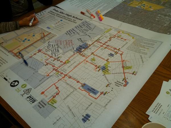
The “walk and roll” map designers, a team comprised of the City of Palo Alto’s Department of Planning and Community Environment and Alta Planning + Design, unveiled its preliminary draft Thursday evening at the Parent Teacher Student Association’s Safe Routes to School meeting. The current map features recommended student biking and walking routes to and from school.
The team chose these routes after analysts accounted for a variety of factors, including data from a walkabout held in September to observe student commute behaviors. The current draft of the map can be found on the city of Palo Alto’s safe routes webpage.
According to Jennifer Donlon-Wyant of Alta Planning + Design, the walk and roll map, when implemented, will not only ensure a pleasant commute, but also help the city decide where money for public works should go.
Paly is not the only school to have its ideal commuting routes outlined. According to Jaime Rodriguez, chief transportation official for the City of Palo Alto, “walk and roll” maps have been drafted or are in the process of being drafted for all Palo Alto schools.
Rodriguez acknowledged the city’s efforts taken to account for the safety of students in all levels of education within Palo Alto.
“Walk and roll maps are uncommon at the high school level,” Rodriguez said.
The final version of the “walk and roll” map for Palo Alto High School is set to be released in early 2014. Until then, parents and students are able to see the current progress for themselves online and submit suggestions for the project.